TxDOT closes ‘Mile-Long Bridge’ over Hubbard Creek Lake for repairs; timeline for project undetermined at this time
By Carla McKeown and Tony Pilkington/Breckenridge Texan
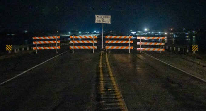
The main route to and from Breckenridge on the west side of the county — the U.S. Highway 180 bridge over Hubbard Creek Reservoir, aka the “Mile-Long Bridge” — was shut down by the Texas Department of Transportation Friday evening, Dec. 22, due to damage to the bridge. The bridge will require repairs before it can be reopened, but a timeline for that reopening has not been determined by TxDOT at this time, according to a news release from the state agency.
County Judge Michael Roach, who also serves as the county’s emergency coordinator, called an emergency meeting at 7:30 p.m. with the Stephens County Commissioners and other county officials; the meeting was attended by emergency responders, City of Breckenridge officials, Breckenridge Independent School District officials and a few concerned citizens. No one from TxDOT attended the meeting, which was held in the district courtroom.
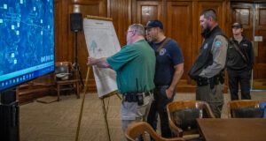
Stephens County Fire Marshal Wayne McMullen, left, and Breckenridge firefighter Jose Garcia, Game Warden Clifton Westbrook and other first responders, look over a map of Stephens County to determine alternative routes for getting to the western edge of the county. (Photo by Tony Pilkington/Breckenridge Texan)
Although the Drive Texas website, which shows TxDOT road conditions, indicates that the bridge repairs are expected to be completed by Jan. 5, the county judge said that, although no one knows for sure at this time how long the work will take, he does not think the Jan. 5 timeframe is feasible.
The news release, which was sent out at about 9:30 p.m. Friday, stated, “TxDOT is working to establish a remedial plan in advance of the repair work, in order to reduce the impact to the traveling public. A date to reopen the bridge has not been established; however, TxDOT is working at this time to coordinate necessary repairs and reopen the bridge as soon as possible.”
When asked if there was any type of estimate for how long the bridge would be shut down, Lisa Tipton, the Public Information Officer with TxDOT’s Brownwood District office said in an email, “It is too soon to know a timeframe. Please know our team has already been working this evening to get the process started. It is extremely important to all of us at TxDOT to get this highway reopened for the community and other travelers. We regret the inconvenience for the traveling public, especially during the holiday travel season.”
The bridge closure will not only cause delays for travelers using U.S. Highway 180 as a thoroughfare, but also for the many Breckenridge and area residents who cross the bridge daily for work, school, shopping, etc.
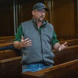
BISD Superintendent Bryan Allen said the school district will come up with a plan for the buses to get to students who live on the west side of the bridge. (Photo by Tony Pilkington/Breckenridge Texan)
The bridge will be closed to all vehicles, including emergency vehicles, so no fire trucks, ambulances or law enforcement officers will be able to use the bridge to quickly get to anyone who needs help. However, there are several firefighters and sheriff’s deputies who live on the west side of the bridge and will be able to respond quickly to emergencies, officials said.
Sacred Cross EMS will work with Shackelford County’s EMS whenever possible, but Shackelford County only has one ambulance, so they may not always be able to assist, Justin Wright with Sacred Cross said at the emergency meeting. Stephens County-based ambulances will continue to respond to all emergency calls, and if the Shackelford ambulance arrives on the scene before Sacred Cross can get there, then the Breckenridge ambulance will return home, Wright said.
BISD Superintendent Bryan Allen attended the meeting and said that the school district will have a plan in place by the time classes resume after the Christmas break on Jan. 8. Some of the bus routes will have to be adjusted to allow for more time on the detours, Allen said.
Lorie Rohloff, who owns Brush Creek Bait and Tackle and attended the emergency meeting, said that she has a lot that emergency agencies can use if they need a place to park vehicles on the west side of the bridge. Additionally, she offered to help any of the elderly residents in the area who need assistance due to the bridge closure.
TxDOT recommends that anyone who needs to travel between Breckenridge and Albany detour to the north, through Woodson via U.S. Highway 183 North and U.S. Highway 283, a route that will add more than 30 miles and about 30 minutes of drive time, from downtown Breckenridge to Albany.
For those who live and/or work south of U.S. 180, other alternative routes discussed during the emergency meeting include taking County Roads 294 and 292 from U.S. Highway 180 to FM 576. However, the County Roads are not paved. Anyone wanting to drive on paved roads in the southwestern part of the county can take FM 576 to FM 601 in Shackelford County and then take State Highway 6 into Albany. Large trucks will need to use the TxDOT detour route, Roach said.
In a Facebook post on the Stephens County page, Roach said the County’s recommended route between Albany and Breckenridge for local traffic is the FM 576 route.
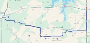
Stephens County recommends the above route to Albany and then back to the west end of the bridge. Pros: Paved Roadway – Safer Route – Higher Speed of Travel. Cons: A few miles longer. (Courtesy of Stephens County)
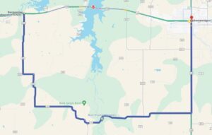
An alternate route provided by Stephens County officials is detailed above. That route is not for commercial traffic. Pros: Shorter Route. Cons: Speed Limit 30 MPH – Livestock Near/On Roadway – Single Lane Cattle Guards & Bridge Crossings – Dirt Roads – Slower Speeds – Less Safe. (Courtesy of Stephens County)
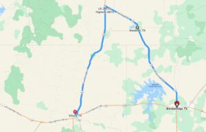
This is the alternate route that the Texas Department of Transportation recommends, especially for commercial vehicles. This route is on U.S. Highways 283 and 183.
Several people attending the emergency meeting expressed concern about traveling on those roads in the dark, as well as about the problems many of the older citizens may have navigating the dirt roads into Breckenridge.

Michael Bartock talks to the County Commissioners about how dangerous some of the alternative routes will be for some county residents. Bartock and his wife, Vikki, right, live on the west side of the bridge and work in Breckenridge. Lorie Rohloff, left, also spoke at the emergency meeting. (Photo by Tony Pilkington/Breckenridge Texan)
“So what you’re saying, then, if we can’t get across the bridge, this is a serious problem,” said Michael Bartock, who lives on the southwest side of the lake with his wife, Vikki, and works in Breckenridge. “I don’t think this is a quick fix. … We’re talking some of those routes taking over an hour at normal speeds during daylight, but at night, if you’re working at night, this is a major issue with with hogs, deer … cattle. Some of those spots, there’s no cell phone service, so if there’s an emergency, there’s some issues out there. I’m concerned that this is not a quick fix.”
Roach acknowledged that the project will likely be a major undertaking and will probably not be quickly resolved.
Later, the county judge said he is working with TxDOT to have warning signs installed east of the bridge, possibly at the flashing light at the intersection of U.S. Highway 180 and FM 2231, to let drivers know that through-traffic is not allowed. Additionally, detour signs may be posted in Breckenridge.
The TxDOT news release did not list a cause for the damage to the bridge or even describe the damage. Stephens County Sheriff Kevin Roach said that the Sheriff’s Office responded to a call from someone who was fishing at the lake and said he saw something concerning with the concrete at the bridge.
“So we contacted TxDOT; they assured us they thought it was cosmetic because there had been a recent inspection — I don’t know how recent– and they were going to go out and look at it,” the sheriff said.
According to information on the Abilene Reporter-News website, which lists data on bridge inspections across the United States, the U.S. Highway 180 bridge over Hubbard Creek Lake (Reservoir) had an average daily traffic of 2,580 vehicles in 2020 with 28 percent of the traffic being trucks. The data, which includes information from the National Bridge Inventory, states that the bridge over Hubbard Creek Lake is to be inspected every 24 months. It shows that the last inspection was in August 2021, but there is no information on the website to indicate how up-to-date it is; therefore, if the bridge has been inspected recently, the data might not be updated yet.
“I don’t live on the west side of the bridge — I don’t know that we have any of our members of our court that do — most of us live on this side — but everybody around this table cares and … we’re going to do our dead-level best to do everything we can as a county and a city and first responders to make sure we make it as painless as we can,” Michael Roach said. “And then (we’ll) be huge advocates for a speedy resolution to this, but I want to be real and be honest and truthful in that … settle in for the long haul, not the short route. And we’re gonna do our best to make it happen.”
Click here to read TxDOT’s complete news release.

The last few vehicles cross the “Mile-Long Bridge” over Hubbard Creek Lake at sunset on Friday, Dec. 22, just before the Texas Department of Transportation closed it due to damage. The bridge will undergo repairs, and a re-open date is not known at this time. (Photo by Tony Pilkington/Breckenridge Texan)
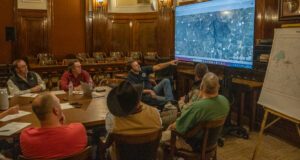
Stephens County Judge Michael Roach, center, and other county officials discuss alternative routes that residents who live on the west side of the bridge can take to get to Breckenridge as quickly and safely as possible. (Photo by Tony Pilkington/Breckenridge Texan)
Cutline, top photo: The Texas Department of Transportation installed barricades, closing the “Mile-Long Bridge” on U.S. Highway 180 over Hubbard Creek Lake on Friday, Dec. 22. The bridge will remain closed to all traffic while repairs are made. (Photo by Tony Pilkington/Breckenridge Texan)
Editor’s Note: This article was updated to include a map of the TxDOT recommended alternate route.


